
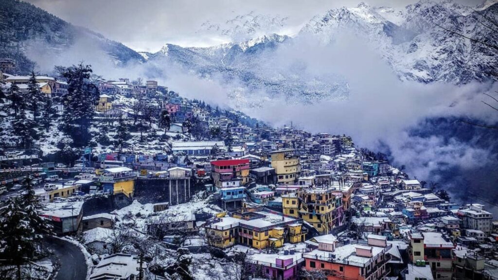
Uttarakhand
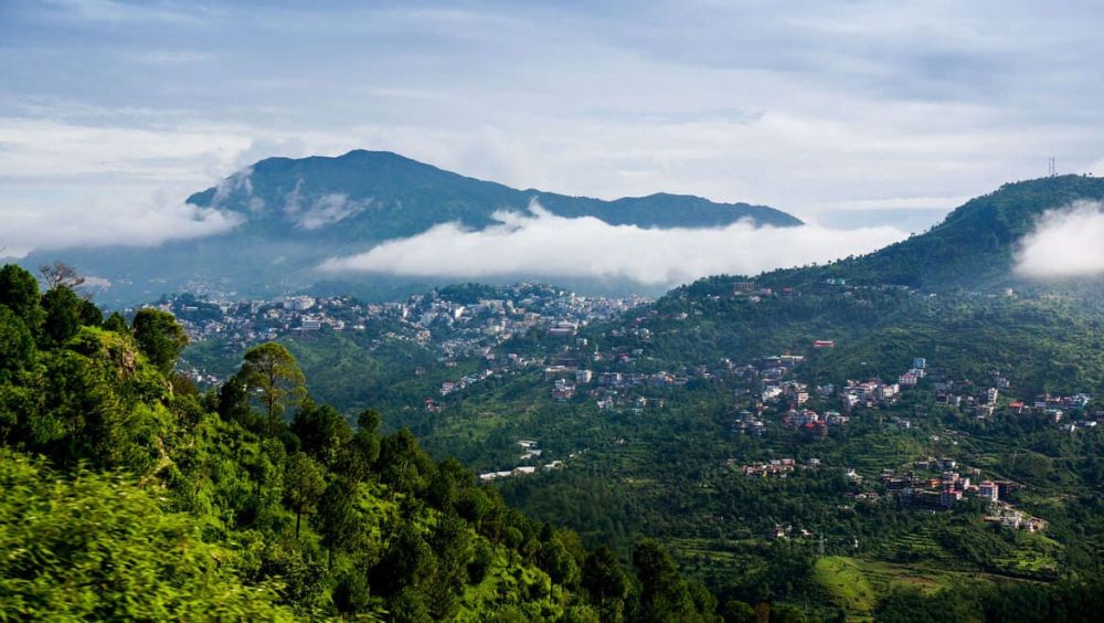
Popularly referred to as Dev Bhoomi (the land of gods), Uttarakhand since it was wedged free from Uttar Pradesh in 2000 has developed its own distinct identity, what with the region’s own distinct languages, history, cultures, river valleys home to interesting micro-civilisations coming together to create a state that is not only special topographically but also unique in its heritage and spirituality. Lying to the northeast of Delhi and surrounded by Tibet and Nepal, Uttarakhand comprises the Kumaon and Garhwal regions which rise out of the sub- Himalayan plains. The snow peaks of Uttarakhand are rated among the most beautiful in the inner Himalayas, continuing in a spine that ends in Nanda Devi, the second-highest peak in the country at 25,643 foot.
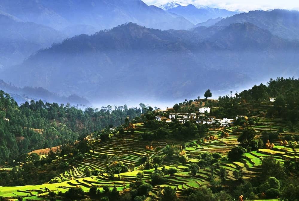
The dramatic terrain of the Himalayan state is defined by azure lakes, frothy rivers, glaciers that are the source of origin of some of Hinduism’s holiest rivers such as Ganga, Yamuna, Mandakini and Alakananda, and frosty peaks, some of which set the backdrop for its most coveted pilgrimages. The high-altitude drives and hikes bringing you to some spectacular pilgrimages, forming the backdrop for Hindu epics.
The place that solemnised the wedding of Shiva and Parvati, also the place that has its colonial legacy aside from the legend of the famous conservationist, Jim Corbett that to this day survives in the famous tiger park that bears his name. Then the coming of the Beatles to Rishikesh, turning the place into a hub for seekers of spirituality and yoga practitioners from all over the world. Uttarakhand’s diversity, its record of being the state with second-highest tiger population, the presence of the Chota Chardham sites and the frosty Himalayan peaks, make it a paradise for travellers.
Places to Visit
Two prominent regions of Uttarakhand
As you plan to book Uttarakhand holiday packages, you need to read up about the two prominent regions that make up this lovely Himalayan state
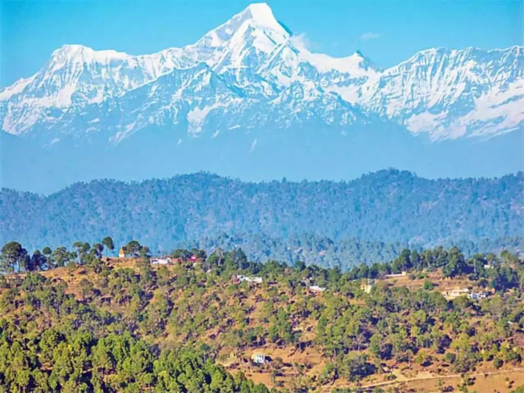
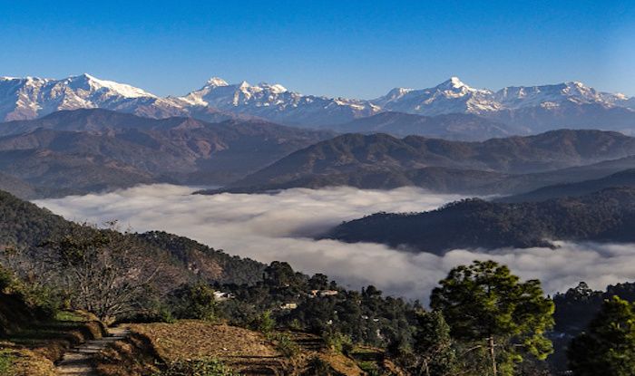
Kumaon: An Uttarakhand trip is incomplete without rounding up the Kumaon region which is home to some truly fascinating sites. Munsiyari, Dharchula, Chaukori, Nainital, Pangot, Binsar, Almora, Ranikhet, Kausani, Ramgarh, Mukteshwar, make up some of the wonderful places you can explore on a Kumaoni holiday. Add to the fact that Kumaon is so well- endowed owing to its topography; the north of the region shares a border with Tibet while the east with Nepal, Uttar Pradesh lies to its southern side and Garhwal to its west, the other half of Uttarakhand. If you visit Kumaon in the winter months between October and March, you will be privy to panoramic views of the Himalayan peaks such as Nanda Devi, Trishul, and Panchchuli. Typically the higher reaches of Kumaon, places like Mukteshwar offer these grand views.
Garhwal: The other significant part of Uttarakhand, Garhwal is also among the state’s most visited regions, especially thronged by pilgrims. In Haridwar, the Ganges after gushing down from the foothills passes through its many ghats before making its journey to the sea. A centre that attracts pilgrims to its famed Har-ki-Pauri ghat. Close by is Rishikesh, sky- rocketed to fame by the British rock band, Beatles in the ‘60s when they arrived in the ashram of Maharishi Mahesh Yogi to seek spirituality and tranquility. Rishikesh with its boho East- meet-West feel, abundant with yoga ashrams and vegan cafes, is the place from which pilgrims typically take off on their spiritual quest for the shrines in the higher reaches, the Chota Chardham comprising Gangotri, Yamunotri, Kedarnath and Badrinath, the sites each being the source of the holiest rivers in Hinduism, namely Ganga, Yamuna, Mandakini and Alakananda respectively. For a cosy stay amid green foothills, pick the hill station of Mussoorie for its distinct colonial feel, and include a stay in its more old-world cousin, Landour.
Places to visit in Uttarakhand
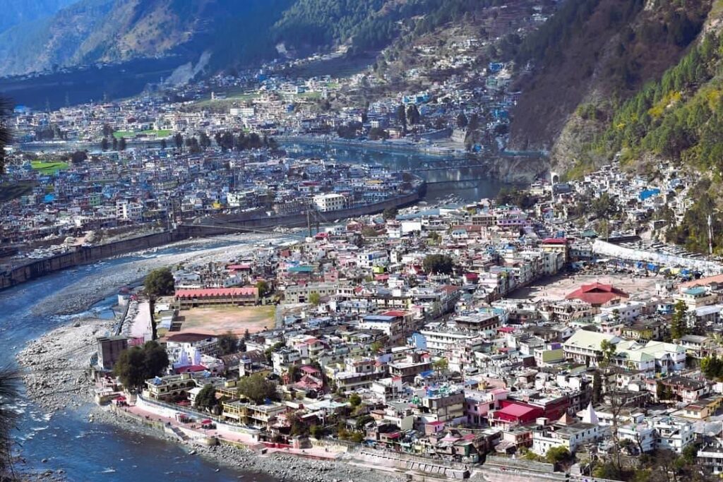
Dehradun, the capital of Uttarakhand
Also a gateway to Uttarakhand, the capital city of the Himalayan state is about 255 kilometre north of Delhi and lies at much lower elevation at 2296 foot, the point from which the Himalayan foothills start their dramatic rise, as a result of which it is neither too hot nor too cold in Dehradun. Lying plump in the middle of the Doon Valley which is 120 kilometre long, Dehradun has the Ganges in Rishikesh to its east and Yamuna to its west. Dehradun is increasingly getting busy particularly around the market close to the Victorian clock tower and the other arterial roads such as the Rajput and Gandhi roads. But any day, the city’s most unique offering is its fine-quality basmati rice, fast developing into a speciality.
Places to visit in Garhwal
Mussoorie:
Among things to do in Uttarakhand, a visit to its British-era hill station is much warranted to soak up its atmospherics, take in a view of the Himalayan peaks and bask in some warm sunshine in an open-air cafe. Mussoorie is spread along a high ridge that is as long as 15 kilometre and is among the closest hill stations to Delhi at 278 kilometre and only 34 kilometre north of Dehradun. At an elevation of 6561 foot, you get your first glimpse of the snow- covered Himalayas from Mussoorie. A retreat for the British Raj since the 1820s, Mussoorie still has several colonial homes turned into heritage hotels. In the centre of Mussoorie lies the two-kilometre-long Mall, a pedestrian-only stretch, home to the hill station’s two most popular hubs – Kulri Bazaar to the east and Library Bazaar to the west.
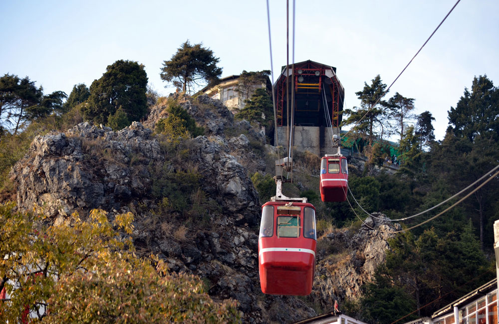
Gun Hill:
A popular viewpoint in Mussoorie, Gun Hill goes up like a volcano in the centre of Mussoorie, affording views of the chain of Himalayan mountains only if the weather permits. You can go up this viewpoint by a little path that forks its way up from the Mall or you could also take a cable car ride from the Ropeway Station close to the Mall.
Sir George Everest’s House: This is a 6 kilometre trek from Library Bazaar through Hathipaon Hill, bringing you to the laboratory and home of Sir George Everest, a renowned Welsh surveyor in 1833 who did significant work on the Great Trigonometric Survey of India that demarcated the borders of British India aside from measuring the height of the tallest peaks in the world. This whitewashed home offers lovely views of the Doon Valley and the Himalayas
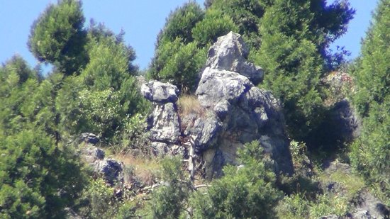
Camel’s Back Road:
As you round up the northern base of Gun Hill by taking a moderately easy 4 kilometre stretch of the Camel’s Back Road, a scenic stretch joining Kulri Bazzar with Library Bazaar, you will come across many viewpoints aside from the rock in the shape of a camel – from where it gets its name – and a cemetery from the British era, also where a British adventurer Pahari Wilson rests.
Childer’s Lodge:
The Childer’s Lodge is spread out over 300 acres and was set up in the 1860s along the slopes of Red Hill, locally called Lal Tibba, just 5 kilometre off the Mall. This being the highest viewpoint, affords truly spectacular views of the Garhwal Himalayas.
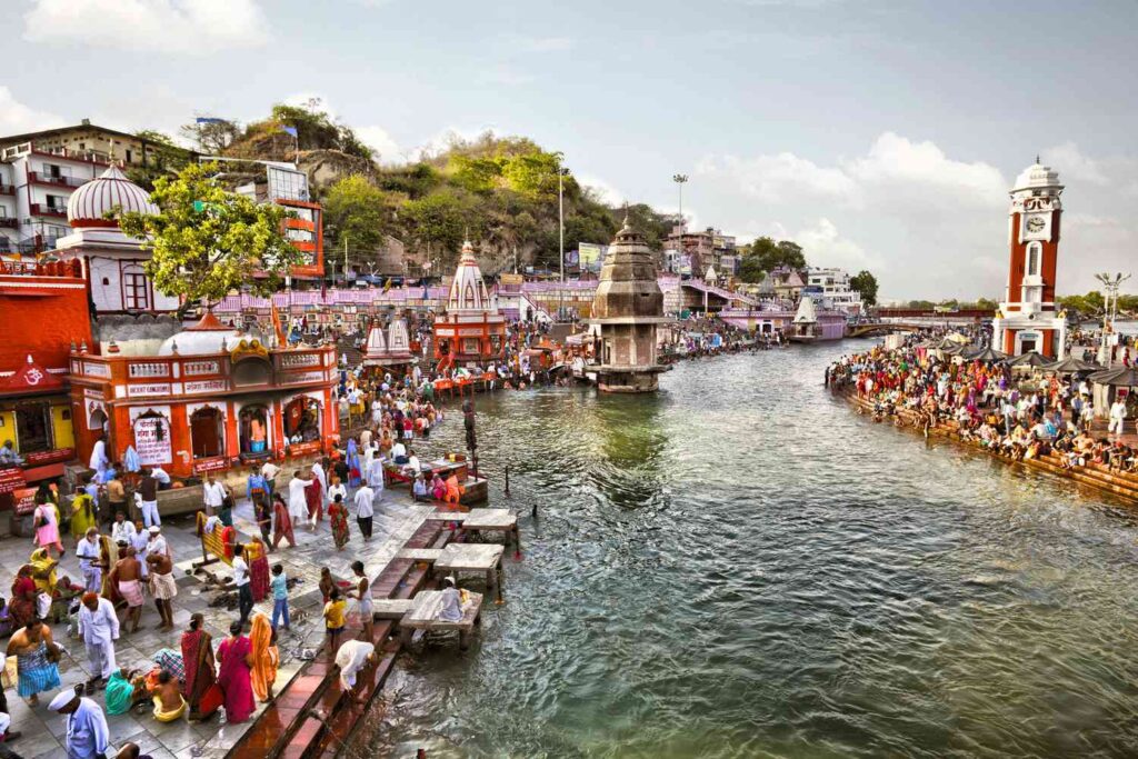
Haridwar:
About 214 kilometre to the northeast of Delhi, this is the place where the Ganges after coming clear off the rapids around the Shivalik Hills, becomes slow as it journeys across North India and later into Bay of Bengal. The Har-ki-Pauri ghat in Haridwar, the spot where the river clears off the mountains, is a revered site for the Hindus, a site marked by the evening Ganga aarti receiving thousands of devotees from across the country, making the place reverberate with a holy aura.
Rajaji National Park:
The Jim Corbett National Park and the Rajaji National Park are part of the same forest reserve, spanning around 830 square kilometre of Himalayan foothills to the east and west of Haridwar. Though there are eight entry gates to the park, the most important one is in Chilla, 9 kilometre east of Haridwar and another gate at Kunnao which is near Rishikesh. With the Ganga barrage in the background, Chilla is a fine base for an exploration into the park. The Rajaji National Park forms the summer homes of the nomadic tribe Van Gujjars, and you will be able to spot the settlements of this tribe on your tour. The park is otherwise notable for its population of elephants and tigers, among several species of rare flora and fauna.
Uttarkashi:
One of the largest towns in Garhwal, Uttarkashi is a great stopover on the way to Gangotri from Rishikesh. Backed by snow-covered mountains, pilgrims take a break in this scenic town and visit the Kashi Vishwanath temple in the centre of the town. Occupying Bharigathi’s fertile valley floor, Uttarkashi is no stranger to natural calamities such as floods, landslides and earthquakes. The bridge to Gangotri was rebuilt post the Himalayan tsunami of 2013. Uttarkashi serves as the starting point for various treks such as the Dodi Tal trek.
Dodi Tal trek:
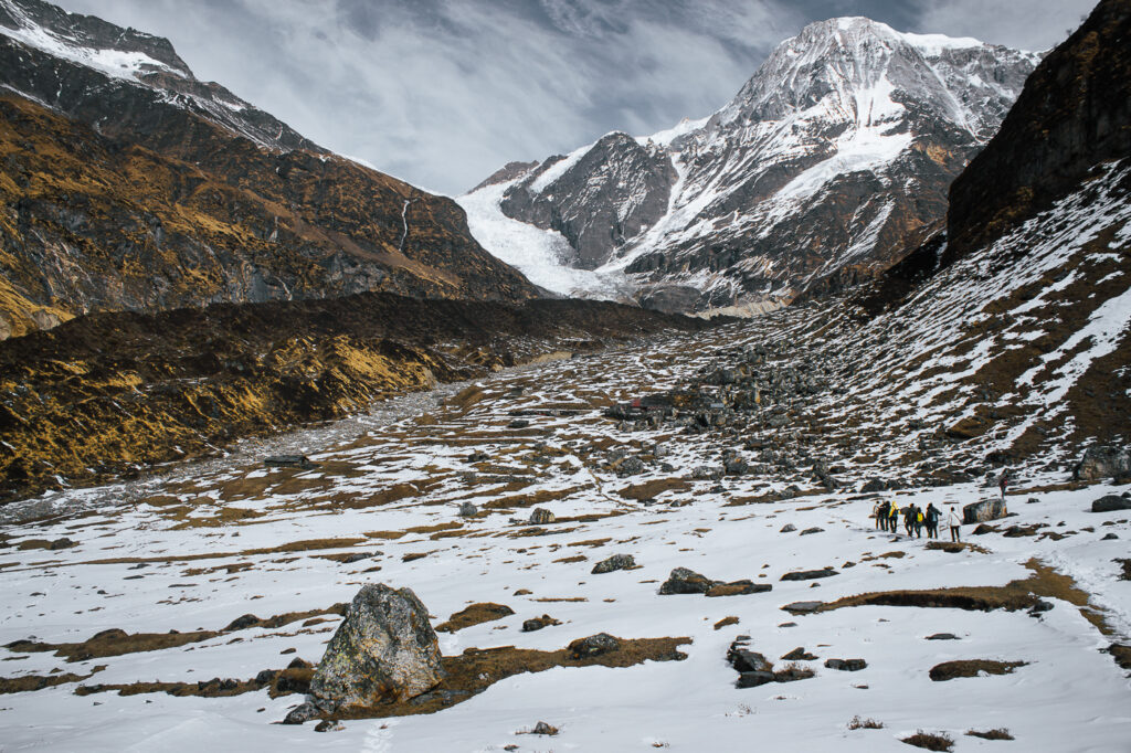
Garhwal’s most popular hike, the Dodi Tal trek connects Gangotri with Yamunotri without taking you into the higher glacial parts. You need to carry food with you and of course your tent, and hire porter and guide services from the local village to take you through some extremely scenic routes. You need to take a bus in the morning from Uttarkashi to Sangam Chatti, which takes nearly 45 minutes and from there you begin your 7 kilometre climb through fields and dense jungles to Agoda at 7500 foot, where you can set up camp or stay in a tourist bungalow in the village. Further, follow the trail towards Asi Ganga that takes you uphill, zigzagging through a wilderness of pine and spruce trees. About 14 kilometre later, you will arrive at the Dodi Tal lake at 9921 foot, the site believed to be where Lord Ganesha was born and even beheaded.
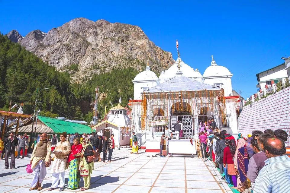
Yamunotri:
Lying at an altitude of 10,803 foot, Yamunotri is nearly 40 kilometre from Barkot in Uttarkashi. Though the actual source of the Yamuna is in the Yamunotri Glacier at an altitude of 20,954 foot, near the Bandarpunch Peaks. As you go to Yamunotri, you can also visit Hanuman Chatti, Divya Shila, Surya Kund and Saptarishi Kund. The Yamunotri Temple is among the Chota Chardham pilgrimages built in the 19 th century and is a 5 kilometre trek from the village, Janki Chatti. The temple is dotted with hot springs where pilgrims cook rice and potatoes which they offer as prasad at the temple. Yamunotri is a lovely forested area and it is truly wonderful to trace the mythological connection of this river with the building of the temple. A dip in the Yamuna, believed to be the daughter of Surya and sister of Yama, the god of death, frees you of all your ill-deeds. There are several charming sites around Yamunotri, from temples, shrines, ashrams, each imbuing its holy aura.
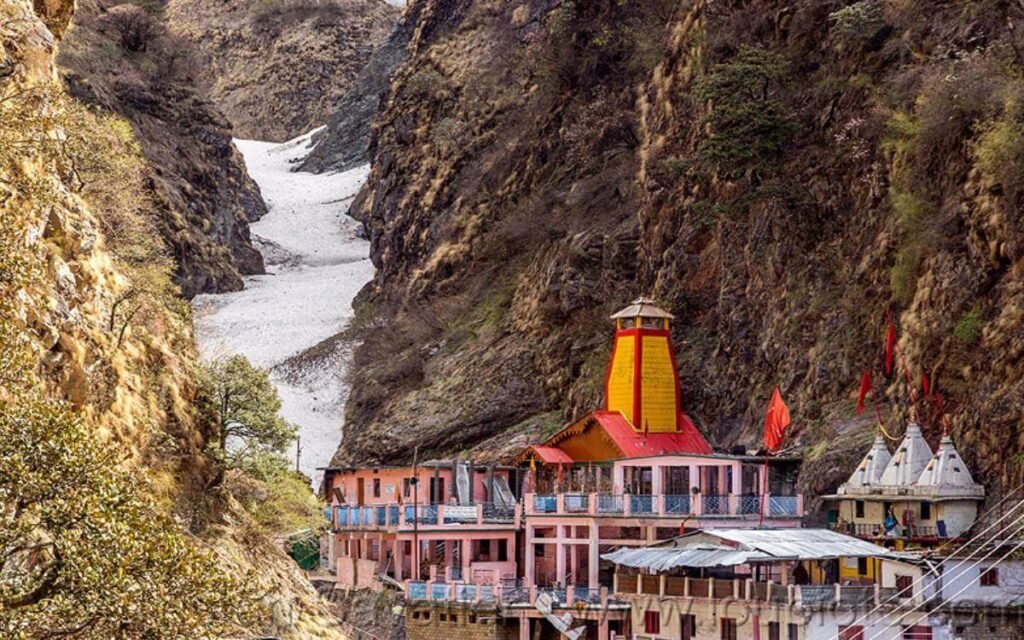
Gangotri:
One of Hinduism’s holiest shrines, the Gangotri Temple, is hugely revered for being the source of the Ganges. Legend has it that the rock near the temple took the force of the river as it gushed down from Lord Shiva’s matted locks, saving the earth from the havoc of the river. To take the onslaught of the river, it is Lord Shiva who had placed the rock on the site strategically. The Gangotri Temple was built in the 18 th century by a Gorkha commander, Amar Singh Thapa. It is the Gaumukh Glacier which is the foremost source of the Ganga river, about 19 kilometre further from the temple. Gangotri lies at an altitude of 10,170 foot on the banks of the Bhagirathi River; Ganga is called Bhagirathi till it reaches Devprayag, where it meets the Alakananda to form the Ganges. The temple opens on Akshay Tritiya in May and closes in Bhai Dooj which is generally around November. Pilgrims fill up their water bottles from the river on site, because Ganga’s waters are known for its healing and spiritual values. The Gangotri region is very beautiful and well-endowed, you will also find several temples lose to the main shrine. During the construction of the temple in the 18 th century, the Gaumukh Glacier was present at the very site, but due to change in environmental conditions, the glacier has receded over the years to its present location.
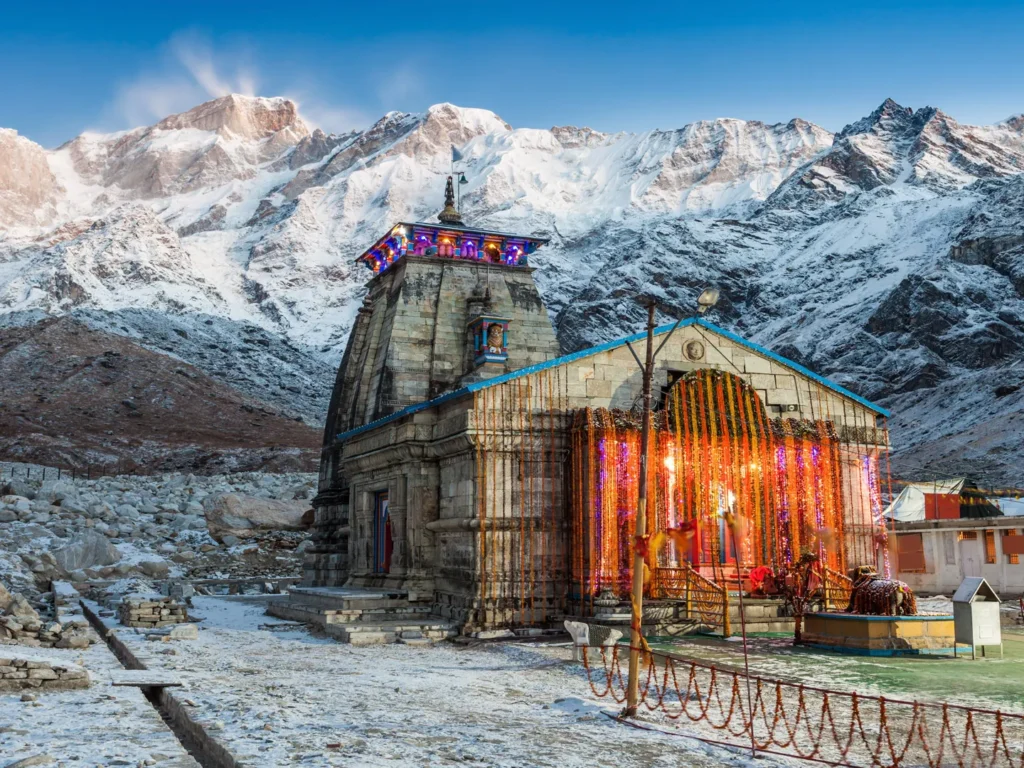
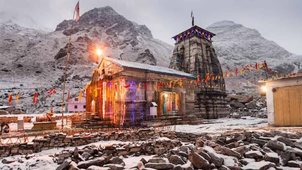
Kedarnath:
One of the Chardham shrines, Kedarnath Temple lies close to the Chorabari Glacier, the source of the Mandakini River at an elevation of 11,755 foot. Backed by snow-tinged Himalayan peaks, Kedarnath Temple has one of the most dramatic settings among Chardham shrines. The last road-head to Kedarnath is Gaurikund which is 14 kilometre away. The stone hump worshiped in the temple has its roots in mythology, in the epic Mahabharata where Pandavas after defeating the Kauravas, also their family members, went to Lord Shiva to seek forgiveness. But Shiva was unwilling to forgive them, but the Pandava brothers remained so adamant in their seeking of mercy that Lord Shiva decided to turn into a bull and came to earth in order to evade them. In a great huff, he ended up leaving his hump in Kedarnath where Pandavas later built a temple and worshiped the hump as Lord Shiva. Kedarnath is among the twelve Jyotirlingas that brings Hindu pilgrims from all across the country to Kedarnath’s bucolic setting characterised by snow-dusted peaks, apple orchards, terraced hill slopes and plunging gorges. You need to trek to the Kedarnath shrine from Gaurikund by taking the trek first to Jangal Chatti, then to Chhoti Linchuli and Badi Linchuli before crossing River Mandakini and arriving at the southern face of the Kedarnath peak.
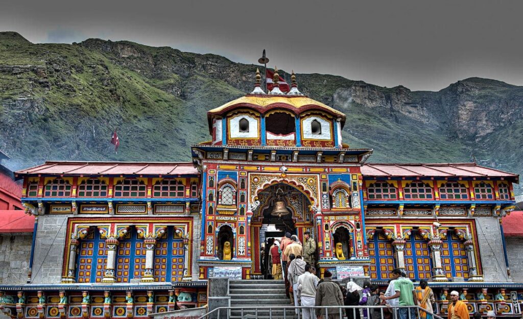
Badrinath:
Badrinath is among the 108 Divya Desams, temples dedicated to Lord Vishnu in the country. Badinath at an elevation of 11,204 foot lies in the Garhwal valley, along the shores of the Alakananda. The Badrinath Temple lies at the foot of the Nilkantha peak, the snow-capped, pyramid-shaped mountain. The temple was founded in the 8 th century by Guru Adi Shankaracharya. The Badrinath town too is very scenic with thick forests surrounding the region, splendid views of the snow-covered mountains, complete with the Alakananda River cutting through its lush valley. There are thermal springs at the foot of the Badrinath Temple whose waters reach a seething 40 degree Celsius.It is believed that Adi Shankaracharya found the idol of Badrinath in the Alakananda River. The present temple was built by the King of Garhwal in the 16 th century and boasts of elaborate carvings, columns, stone embedding, making it look like a Buddhist Vihara.
Joshimath:
It lies 250 kilometre northeast of Rishikesh and hangs from the side of a lush valley affording surreal glimpses of the snow-capped Garhwal Himalayas. Pilgrims on their way to Badrinath make a halt in Joshimath which is the spot where Adi Guru Shankaracharya attained enlightenment under a mulberry tree before going ahead to set up one of Hinduism’s four centres, the Jyotiramath. The town divided into Upper and Lower Bazaars has its share of colourful temples. A 4 kilometre cable car journey connects Joshimath to skiing slopes of Auli.
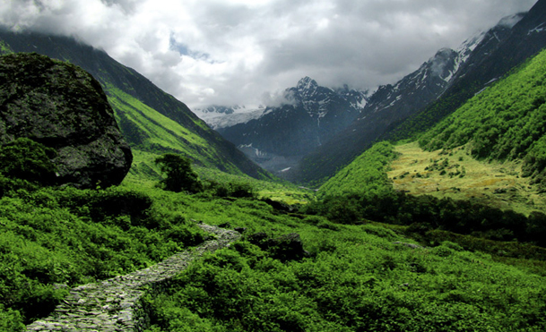
Hemkund and the Valley of Flowers
From the mountain village of Govind Ghat, a trail goes 14 kilometre up a steep path to the village of Gangharia, also known as Govind Dham at 10,000 foot. This place is a stopover for several Sikh pilgrims to Hemkund Sahib and for those trekking to the Valley of Flowers. From Govind Dham if you trek 6 kilometre further up a steep, stony path, you will reach the partly- frozen Hemkund Lake at 14,202 foot. In the Guru Granth Sahib, Govind Singh mentions meditating by a lake surrounded by seven high mountains, but it was only in the 20 th century that this lake was discovered. On the site now stand a big gurudwara and a shrine to Rama’s brother Lakshmana. An alternate trek winds its way left from Govind Dham, leading to a 5 kilometre climb through the Bhyundar Valley or the Valley of Flowers. The valley at an elevation of 10,997 foot was discovered by mountaineer Frank Smythe in 1931 who named it so for its splendid range of rare and exotic flowers. Spanning over an area of 10 kilometre, it is virtually impossible to explore the entire valley on a day’s hike.
Places to visit in Kumaon
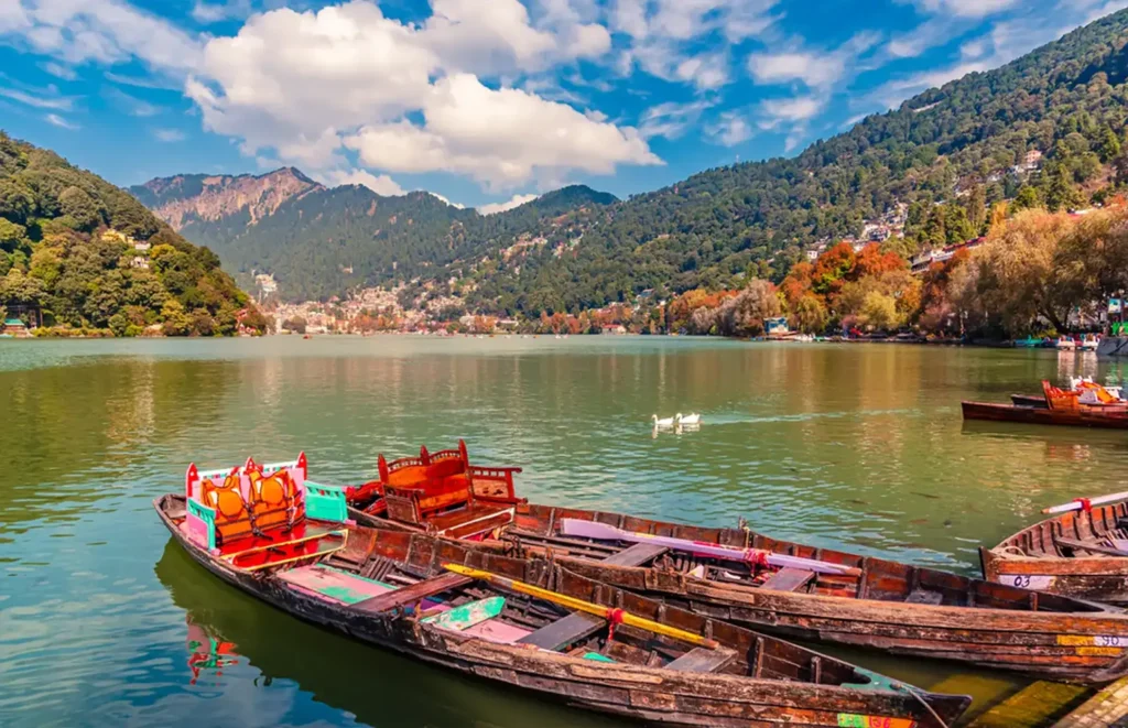
Nainital:
Symbolised by the small, teardrop-shaped lake in the heart of the town is Nainital set in a mountain hollow at an elevation of 6358 foot, being about 277 kilometre north of Delhi, making it the largest town in Kumaon. Nainital was founded in 1841 by a Mr Barron, a European sugar merchant and later turned into a popular escape from the summer heat of the plains. Tourists, from students, backpackers, honeymooners, families, throng this hill station round the year with a specially heavy footfall in the Mall area, a 1.5 kilometre promenade lined with shops selling candles, handicraft, wooden toys, apart from restaurants and cafes. Nainital’s position within the inner Himalayas affords it some stunning vistas from its various vantage points. You can club your visit to Nainital with Sat Tal, Bhimtal, and Naukuchiyatal.
Make sure you head up, 51 kilometre away to Mukteshwar, which apart from great views of the Nanda Devi and Trishul peaks is home to an ancient Shiva temple quite popular with Hindu pilgrims.
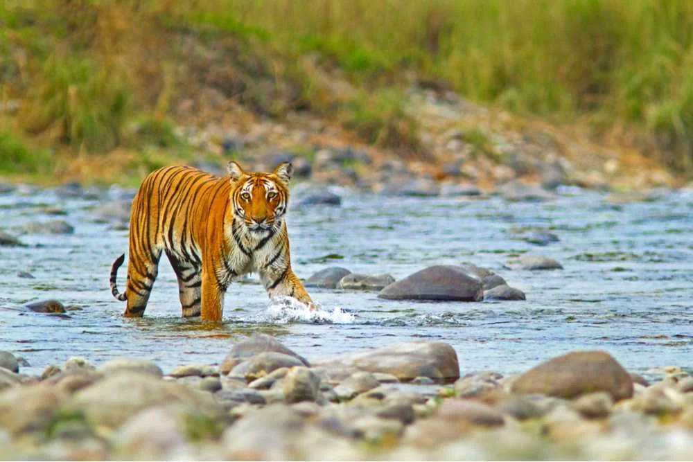
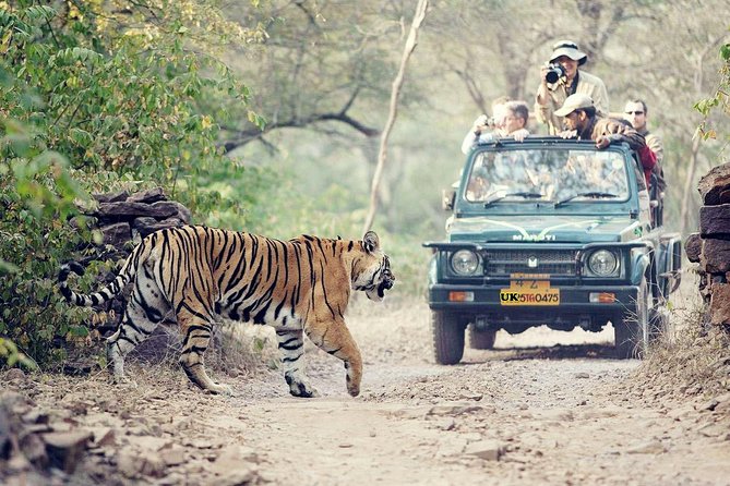
Jim Corbett National Park:
About 63 kilometre southwest of Nainital is the Corbett Tiger Reserve, one of India’s premium most wildlife sanctuaries. The park was set up by conservationist Jim Corbett in 1936 as Hailey National Park and had covered 1288-square-kilometre of the Kumaon foothills under the shade of deciduous and sal forests, providing wildlife its impenetrable cover. Corbett is known for its population of the big cats apart from an array of wildlife such as gharial, jackals and an assortment of birds. The various gates through which you can access Corbett include Dhikala, Bijrani, Dhela, Durgadevi, Jhirna, and Sonanandi, though most tiger spotting happen either in Dhikala or Bijrani. You can take a jeep or canter safari into the park and spot wildlife along the way.
Ranikhet:
A little, though slightly uninhibited, hill station in Kumaon, Ranikhet at 5984 foot, about 50 kilometre west of Almora, is quaint, picturesque and an army cantonment belonging to the Kumaon Rifles. While the Sadar Bazaar area of Ranikhet is quite crowded with plenty of hotels coming up, but the further upwards you climb, you will encounter a more peaceful setting under the shade of tall pine trees. There are ample nature walks, and spots to catch sunrise and sunset from. There are some lovely, quiet homestays in the region which you can choose for your stay, away from the crowds that agonise Nainital.
Almora:
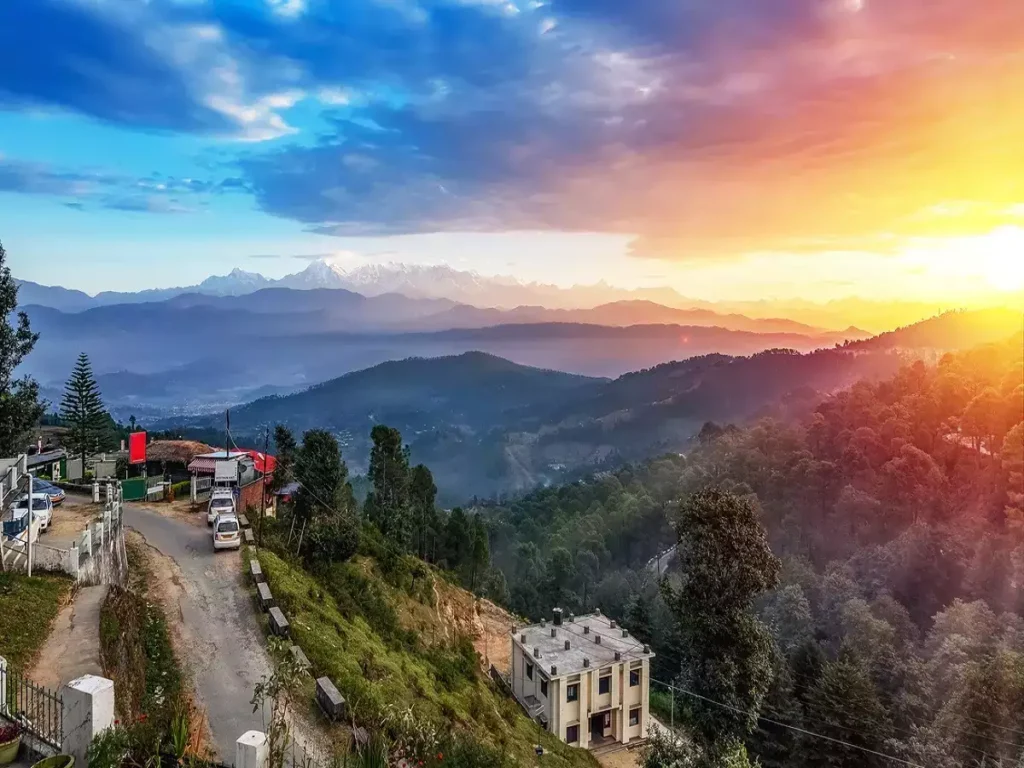
Almora at an elevation of 5400 foot is about 67 kilometre north of Nainital and sprawls out across a hilltop that overlooks lush terraced fields. It can be easily regarded as Kumaon’s cultural capital, also for being founded in the 16 th century by the Chand dynasty and being occupied first by the Gurkhas and then the British, Almora is a market town, bringing in a motley crew of visitors round the year including Swami Vivekananda, the author of The Way of the White Clouds and Tibetologist, Lama Angarika Govinda, American psychologist and writer, Timothy Lear among several foreign visitors. Kasar Devi, about 8 kilometre north of Almora, is a popular destination for several religious travellers.
Kausani:
About 52 kilometre northwest of Almora is a quaint hill station, basically no more than a village, Kausani stretches east to west on a splendid pine-covered ridge of the mountain. A stay in Kausani opens you up to the panorama of Nanda Choti, Nanda Devi, Trishul and Panchchuli, especially around dawn or dusk. Visit the Mahatma Gandhi ashram housed in a tree-fringed, peaceful setting, with memorabilia and pictures from the Mahatma’s life who walked here in the year 1929, thirty years ahead of the building of the main road. You can take several short day hikes through the pine wilderness that opens up to terraced valleys Kausani is surrounded by. About 4 kilometre north is the pleasant trek to Kausani Tea Estate and by going 10 kilometre down the valley, you will arrive at the Baijnath temples. Further ahead from which is the pilgrimage destination, Bageshwar as well as the trail-head going to the Pindari Glacier.
Pindari Glacier trek:
One of the considerably easier treks in Uttarakhand and definitely in the Kumaon region is the Pindari Glacier trek, with the glacier stretching over 3 kilometre in length and about 500 metre in width. It passes through the unspoilt high mountain region and several little Himalayan hamlets, taking you to the source of the Pindar River, affording on the way views of the Nanda Kot, Maiktoli and Panwali Dwar peaks. The trail begins from Song and even ends there, being at an elevation of 5249 foot, the entire trail, to and fro, is 90 kilometre long and takes nearly six days to fully complete, going past the Dhakuri Pass at 8792 foot and the last settlement, Khati to get to the Zero Point at the edge of the coveted Pindari Glacier at 12,007 foot. You need to carry your own sleeping bags and other camping equipment for the trip.
Best time to visit Uttarakhand
Lying in the lap of the Himalayas, the climate of Uttarakhand remains between pleasant to cold through the year, a reason it attracts tons of people from the plains. To escape the heat of the plains you can visit the mountain state in summer between April and June and enjoy the pleasant bucolic setting. For a bout of skiing, you can visit in winter between December and March. The snow fall in the higher reaches lasting till the end of February. Monsoon, however, is not a great time to travel there owing to intense rains causing many of its rivers and glaciers to break their banks and cause subsequent flooding.